Saturday, July 24, 2010

Week 10


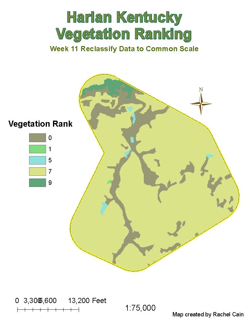
These past two weeks were all a little confusing. I like working on a project from beginning to end. There were too many blurred areas. This week was filled with alot of error messages that I was either able to figure out on my own or found help through the disscussions. So thanks to all on the discussion board.

Monday, July 5, 2010

Week 8

Here are three maps showing the density of three different crimes in D.C. There are a few areas that have common higher densities of all the crimes.
This map shows the crimes in the area and the distances from the police stations. I gave my thoughts on places that D.C. should put new stations to get a better handle on the crime in the area.

This map was straight forward and easy. No problems with this one.


Tuesday, June 29, 2010

Remote Sensing Challenge 1

Here is my first map for remote sensing. Right now I don't like it some much because it isn't very colorful and attention grasping.

http://students.uwf.edu/rlc36/challenge1pensacola.xps

Sunday, June 20, 2010

Week 6


So this took me way more than 3 hours. But is wasn't hard just tedious! I also tried to make them look really good so hopefully I succeeded!

Monday, June 14, 2010

Week 5 Urban Planning


I like when the assignments are straightforward like this week. No complaints coming from me after last week.

Wednesday, June 9, 2010

Huge Disappointment


Well I worked on this project for several days. I read all the help that people were so willing to give but I got no where. I was on the brink of tears on several occassions due to frustration. The first image was the message that I recieved no matter what I did. I deleted everything I had atleast 6 times. I still would like to figure it out this project. Thank goodness I did the extra credit hopefully that means is wont be a complete F. But I am definitely not proud of this map. At some point I have to get some sleep. I worked till 11:40 last night and 10 tonight.
Ugh I hate pushing the publish button for this map........

Week 4 Summary of the Role of GIS in Disaster Response

The role of GIS in disaster response is mapping the damage extent. This allows us to then see the areas that are going to require the most aid. By having the accurate documentation of the destruction the government is more willing to give money to the rebuilding efforts. The GIS maps show a close figure of what the cleanup costs are going to be. They show the best areas to put up assistant centers, for the long term needs people will have. For communities trying to regroup there are maps that show demographic, cultural and linguistic factors of the area.

For the Deepwater Horizon Oil Spill, GIS is showing where the projected path of the oil is compared to the previous days. They also show the coastal regions that are already being affected. The maps of the coast show the communities, the wildlife, the environment, etc. By mapping all the factors the cleanup efforts can be focused on the areas with the most needs. Then the second round of maps shows, the areas that have already been harmed and to what extent they have been damaged. The economical damage from the loss of tourism will also be displayed through the maps that will be created. Then BP will know how much they are going to owe everyone.

Sunday, June 6, 2010

Week 4 Oil Spill

http://students.uwf.edu/rlc36/DeepwaterHorizonVideo.avi

I didn't encounter any issues when creating the video but I was wondering if this was all that the video needed to include.

Tuesday, June 1, 2010

Week 3 Hurricanes


For the Infrastructure and Flood Region my biggest issue was the labeling. It was taking to long to load so I kept thinking I wasn't doing it right. The chart on the Flooded Lands surprised me. When I was just looking at the map I saw more agriculture being flooded, that was wrong.

Tuesday, April 27, 2010

Tuesday, April 6, 2010

Week 11 Reclassify Data to Common Scale

I liked this very simple project the only problem was finding the right color for the ranking.

Monday, April 5, 2010

Spatial Analyst Week 11

The only problem I had was with step 8. It said that the parameters were wrong and it couldn't excuted the task. Hopefully this map will work with what I needed.

Week 11 Creating and Editing Labels and Annothtion


Week 11 Map 1


Friday, March 26, 2010

Week 10

Wish I would have decided to work during spring break, simple lab no problems.

Monday, March 22, 2010

Week 10

No problems with this lab once Amber helped me with logging in. I did have troubles getting the finished product to look like I wanted it to.

Answers to the questions:
1. I tried the intersect tool to look at the differences. I saw no great differences.
2. I used the erase tool. It removed all of the overlapping layers so the camp sites wouldn't run into any of the conservation areas.
3. I had 79 features in my new layer. My largest area was 7765034 sq meters and my smallest area was 748 sq meters.

Wednesday, March 3, 2010

Week 7

Glad to be done... no big problems just a little time consuming for little results.

Tuesday, February 23, 2010

Week 6


I liked it once I knew what I was doing. I really didn't have any issues making this map. I was able to do this assignment fairly quickly.

Final Map on Week 5


I couldn't figure out the DRG quad and a few things arent perfect but I learned alot and tried my best!

Friday, February 19, 2010

Week 5 Still Going


Here is map two. The problems I had was the vague attribute tables. The Strategic Habitat Conservation Areas only had four attributes. The wet lands also didnt have were I could select only certain counties. I tried to make it work.

Wednesday, February 17, 2010

Week 5 Map 1


First map done...two more to go.... not looking forward to it. This map took a lot of time and caused a lot of stress! I had some issues with getting the information to only be in the Sarasota borders and still didn't get them perfect. Also after adding all the information it wouldnt let me save the mxd map. If anyone knows why it would be very helpful. Also is anyone else having problems with Arcmap running really slow?

Friday, February 12, 2010

Haiti Map


I found this map just through a google image search. I liked it because it shows where Haiti is on the globe, the landscape, the borders, and some of the major cities. It is a very clean map that shows a lot of information.

Monday, February 8, 2010

Week Four Lone Activity

This week I really didn't know where to get started. I probably added a lot of unnecessary steps to get this map. Then it wouldn't let me save the map. It said file writing error, so I had to print then scan the map to make it a file. At the end I was happy that I was able to do it all by myself.

Thursday, January 28, 2010


My only issue was trying to find the best colors, it was worse then trying to pick out an out an outfit.
I just had some issues with the labeling. I pushed the wrong button on something and had to start over from the first map this week.

Week 3 first map

The biggest issue I had was making the new layer. The place I wanted to save it at was invalid so I had to save it in the wrong place where they suggested me to. Also when I was starting week three my H drive didn't have enough space.

Tuesday, January 26, 2010

Week 2

I had some issues when I was changing layouts. When I went to layout view my map completely disappeared and I couldn't make it work. I had to go to the full edesktop and redo the whole map. If anyone has any ideas as to why this problem came up please give me some feed back.

Tuesday, January 19, 2010

I enjoyed this exercise however, I don't know if I could repeat it by myself.


I found that this map was not too hard to create. I'm glad to see that the instructions thus far have been very straight-forward.